The Allure of Untamed Isolation
While Tromsø and Lofoten enjoy prominent marketing and extensive hospitality chains, Senja has consciously retained a rugged, working maritime identity. Located between the Tromsø archipelago and Vesterålen at 69°20′N, the island sits squarely beneath the auroral oval. Here, light pollution is virtually nonexistent outside small fishing hamlets like Gryllefjord, Senjahopen, and Husøy.
The geography of Senja is split into two contrasting personalities: the western coast, violently battered by the open Atlantic and characterized by razor-sharp rock teeth plunging hundreds of metres into deep fjords; and the eastern sheltered interior, marked by gently rolling birch woodlands, tranquil waterways, and farms reminiscent of southern Norway.
Key Observation Sanctuaries
Chasing northern lights on Senja is a journey through national scenic byways carved into coastal rock faces:
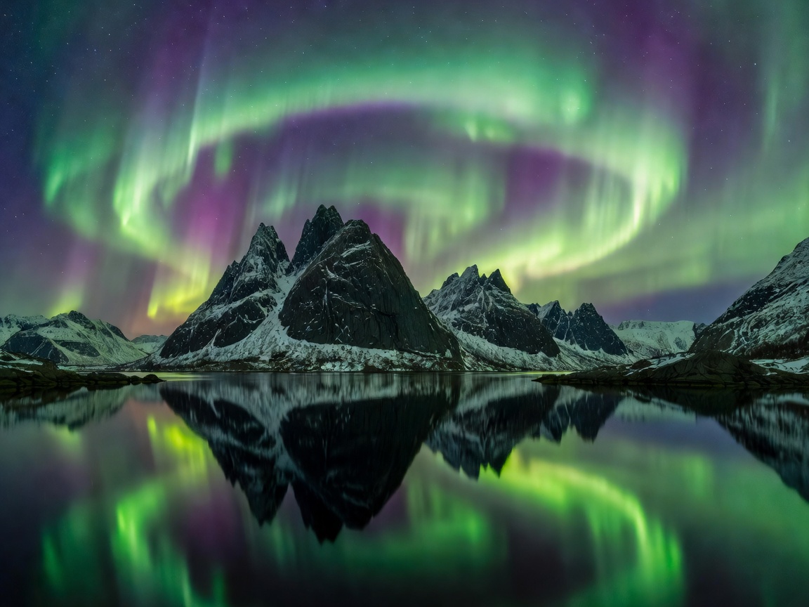
- Tungeneset & The Okshornan Spires: Located between Steinfjord and Ersfjord, a raised wooden walkway leads across storm-smoothed granite flats to reveal Okshornan—famously known as the 'Devil’s Teeth'. When the northern lights erupt over the jagged row of sea needles, the natural reflections in sea-filled tide pools create iconic visual symmetry.
- Bergsbotn Viewing Platform: A 44-metre cantilevered wooden lookout soaring high above Bergsfjorden. Observers standing on the platform look down into the dark expanse of fjord islands while auroral curtains drape over surrounding mountain crests.
- Mefjordvær: An authentic fishing settlement anchored at the mouth of Mefjorden. The seawall barrier offers an unobstructed northern viewpoint straight out into the polar sea, free of street lamps and commercial signs.
- Ånderdalen National Park: For cross-country ski expeditions and winter snowshoe treks, Ånderdalen offers virgin snow plains, old-growth coastal pine forests, and absolute silence beneath the solar winds.
Critical Field Note: Winter Tunnel & Road Conditions
Senja’s National Tourist Route features numerous narrow tunnels and single-lane avalanche shelters. Ice stalactites frequently form inside unheated tunnels, and coastal switchbacks can accumulate sudden black ice deposits. Never halt your vehicle inside tunnels or around blind rock shoulders to view sudden auroral outbursts.
Contrasting Advantages: Senja vs Commercial Arctic Hubs
| Evaluation Metric | Senja Wilderness | Tromsø / Central Hubs |
|---|---|---|
| Light Pollution Level | Virtually zero (Bortle Class 1 – 2) | Moderate urban core (Bortle Class 4 – 5) |
| Tourist Congestion | Extremely low, solitary vantage points | High tour bus volume at key pullouts |
| Commercial Infrastructure | Limited winter dining, self-catering focus | Dozens of hotels, gear rentals, restaurants |
| Route Flexibility | Fewer connecting roads; mountain passes close | Multiple national highways into Sweden/Finland |
Winter Logistics and Practical Expeditions
Reaching Senja during mid-winter requires planning. The summer car ferry connecting Brensholmen (Kvaløya) to Botnhamn operates reduced winter schedules, meaning travellers often drive the mainland route via Finnsnes via the Gisund Bridge. Accommodation on the island primarily consists of converted fish houses, wilderness lodges, and seaside apartments. Visitors should ensure groceries and full fuel tanks are secured in Finnsnes before crossing onto the island, as rural petrol pumps can be far apart.
Conclusion: The Purest Arctic Sky
For independent travellers, landscape photographers, and wilderness purists who prioritize unhindered views of the auroral oval over tourist attractions, Senja remains one of Norway's most rewarding frontier destinations.